For history of Lalbagh Fort see
:Lalbagh area and Fort incident, and
Lalbagh Qilla (Fort), Dhaka 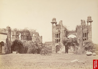
This is how the British rule treated with the Mughal splendor of Bengal (pic 1870)


The look of Lalbagh Fort during 19th century - 100 years after occupation by the British

1874 sketch of Ruined gateway of Lalbagh fort

Viewed by Collector of Dhaka,
Charles D'oyle in 1816 AD - his etching of Lalbagh Fort's south west corner from river (Qillar Mor)

view of Lalbagh Fort (photo: johnson and Hoffman 1880s)

Neglected Paribibi's tomb in 1904 (pic Fritz Kapp)
 Pic from Banglapedia
: Lalbagh Qilla (Fort) sketch reconstructed after excavation by Bangladesh Archeological Dept. (Fort Area: 18 acres). Excavations revealed remains of 26/27 structures with elaborate arrangements for water supply, sewerage, roof gardens, and fountains.
Archeologists after a recent excavation discover continuity of the main fort walls towards east below Shaishta Khan Road and opine that the present area of Qilla only represents half portion as planned by Prince Azam Khan. The gate at south east of Fort (adjacent to Lalbagh Shahi Masjid) as per requirement fits properly as the Central Gate in the middle of Fort, the other half on east- likely palnned for administrative purpose (Girde Qilla area)- were incomplete or extinct long ago.

South west corner (Qillar Mor) - reconstruction and renovation in progress. Narrow lane beside the south wall is Kazi Reazuddin road.
Many elderly still remember this corner as 'riot-er mor' (the junction of riot), the name preferred by the British after crushing the uprising in the fort in 1857 known as the 'first Independence war' (Sipahi bidroho).
View from south west corner (kiosk) of Fort. The dense area linking 'Kamrangir char' was once part of river
Buriganga, where from Charles D'oyle drew his famous etching of Lalbagh Fort in 1816 AD.


Reconstruction of south east corner gate of fort (main gate). Behind stands the
Badshahi Masjid of Lalbagh.

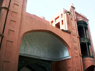

Dexterous work of renovation of the south east gate


South east gate (Main gate) then stood at the bank of river Buriganga (now near 'posta')

View of the small north east gate (near Lalbagh road) from the main south east gate of fort

Beauty of a fortress wall from inside
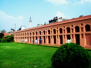
The southern fortification wall upto west end have 5 bastions at regular intervals. The central one contains an underground room (pic below) with verandah on three sides, and it can be approached either from the riverside or from its roof. The double-storeyed bastion at the southwestern corner of the fort was possibly a
Hawakhana, with a water reservoir and garden on its roof. Two lines of terracotta pipes were discovered that connected all establishments of the fort with this reservoir. An extra-strong terracotta pipe line made with double pipes, one inside the other, was uncovered in the area between the
Hammam (bath house) and Paribibi's tomb.

Fortress wall central entry - viewed from Paribibi's tomb

Fortress wall on west

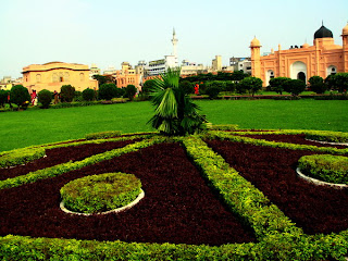
Area for 'Hawakhana' and garden with water reservoir
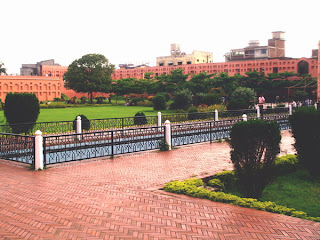
Renovated Fort area - south west. The passage on right goes to Mosque.
The southern fortification is a twin wall, the outer one is about 6.10m high and 1.37m thick, while the inner one is 13.72m high with same thickness. The two are solid up to the height of 6.10m and there are regular openings in the upper part of the inner wall.

View of Mosque and Paribibi's tomb

Paribibi's tomb - south view

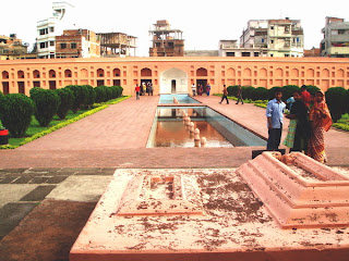
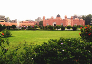
View of Hamman khana (public bath), Paribibi's tomb, Mosque and beautifully laid garden according to original design. Lalbagh Badshahi mosque (Shahi mosque) seen at the rear.
Remains of floral wreaths on the graves south of Paribibi tomb
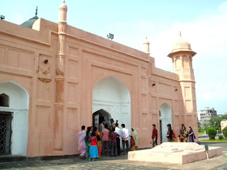
Visitors queing at Paribibi's tomb from south
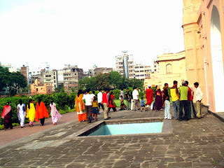
Visitors on the north


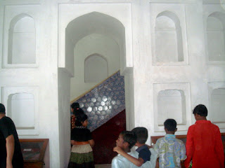
White marble wall and jali (marble screen) work inside tomb

White marble Tomb of Paribibi (meaning Fairy lady)- original name said to be "Iran Dukht" was known to be the daughter of Shaista khan, the then Shubahder of Bengal and wife of prince Azam 3rd son of Emperor Aurangzeb.


Diwan-i-Aam (top), and Hammam khana (below) - east of Paribibi's tomb
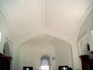
Entry hall to
Diwan-i-Aam (Hall of public audience) and
Hammam Khana
Hammam (bath) room with water storage, bath tub, kitchen and a oven at one corner
Roof of Diwan-i-Aam (audience hall)

Mughal Cannon on display beside Diwan-i-Aam


Fort Mosque on west: The fort was considered to be a combination of three buildings (the mosque, the tomb of Bibi Pari and the Diwan-i-Aam and Hammam), two gateways and a portion of the partly damaged fortification wall. The underground water line and tank can be seen beside the Mosque.

The smaller gate of fort at north east corner (adjacent to present Lalbagh road)

Shape of an incomplete gate of the Mughal era in the middle of north wall (now the enrtry gate of Fort for visitors).


Visitor's delight in the fort

Lalbagh Fort is now under control of Archeological Dept. and open for visitors 6 days a week. Admission to the fort is Tk 5.
A fast-track historical journey back to ancient Dhaka with the 300-year-old Lalbagh Fort in the spotlight is in process through 'Light and Sound' in Bangladesh. According to the proposal, the project is to be completed in three phases. The first phase had been completed in June 2006. The second and third phase will include the main project work and are nearing completion. When completed, the architectural heritage of old Dhaka can be a good source of entertainment for city dwellers, and educational as well.


