

Fulbaria Railway Station - Arrival of Lord and Lady Curzon in 1904 (photo: Fritz Kapp)

Built for Provincial Secretariat Building during 1910's (now Dhaka Medical College & Hosp) - Railway track seen in the foreground
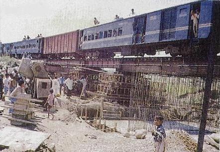
Tongi Railway bridge under repair in 60's

Old Fulbaria Railway Station turned into Bus Stand (south of Nagar Bhaban) - photo: Mr. Jafrullah

Rly Head Office, Ramna, Dhaka- vintage coal-burn steam engine in display
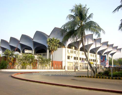

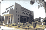
New Railway station at Kamlapur, Dhaka

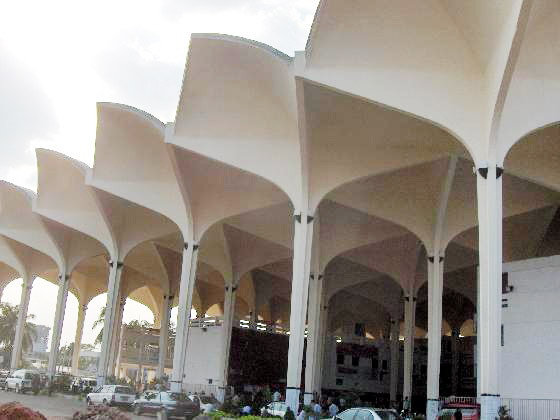
Platform - Kamlapur Railway Station (photo: during Eid holidays)
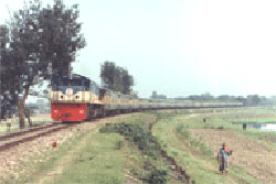
Train on the move

Inside of a coach


Engine - old and new

Old engine of goods
Railway Office at Ramna, Dhaka
Fulbaria Railway Station: In the Mughal period, Dhaka saw dramatic rise and development due to its geographical, political and administrative importance as the capital and later as the sub-capital of Nawabs of Bengal as a wealthy and resourceful province (its flourishing trade and manufactures, especially the Muslin). The city stretched seven to ten miles along the Buriganga River and up to two and a half miles inland. The suburbs extended from the Buriganga to the Tongi Bridge on the north, and Mirpur- Jafarabad to Postogola in the east. The city with its suburbs was said to have a population of some 900,000.
The decline of the political power of the Nawabs of Bengal and the rise of the British East India Company led to the waning of the administrative importance of Dhaka in the late 18th century and had a catastrophic impact upon the population and physical boundaries of Dhaka. In 1801, the city had a population of some 200,000, and by 1840 it dwindled to 51,636. Most places became totally desolate.
Since mid-19 century, a new era for the city began ushering in a new phase of development when the British in 1862 opened up a 53.11 km broad gauge rail track from Darsana to Jagati. Next section, a meter gauge, was opened between Dhaka to Narayanganj, a distance of 14.98 km on 4th January 1885. In 1895, two more sections of meter gauge opened between Chittagong and Comilla (149.89 km) and between Laksam and Chandpur (50.89 km) as part of Assam Bengal railway.
Narayanganj-Dhaka rail track was extended upto Mymensingh in 1885-86. The lines laid almost parallel to the Mughal road from Tongi to Tejgaon, Karwanbazar to Shahbagh, then it formed a loop around Ramna and turned towards the east cutting through the Nimtali-Fulbaria area.
The placement of the railway line gives an idea about the existence of the main city in the areas south and west of the loop. Fulbaria area was developed into a big complex for the Railway including railway station for Dhaka. That changed the northern side of Nimtali and Nawabpur. Suburb of Segunbagicha, Purana Paltan, Dilkhusa and Motijheel developed and a thriving educated community moved over there from south. Curzon hall, Viceroy’s house, Institutional buildings and spacious Bungalows made Ramna a pleasant area away from din and bustle.
After Partition of 1947, the picture was totally changed, city population increased manifold and there was acute shortage of accomodation. For Government housing, thatched barracks were added on empty land of Plassey (Palashi) and Nilkhet. New residential flat blocks were built in Azimpur and Motijheel area and light industrial zone set up in Tejgaon. But, the rail line passing through the heart of city stood on the way of city's proper development.
Thus, in mid-1950’s the work of shifting railway track eastward from Tejgaon to join the old track near Swamibagh-Jatrabari through Rajarbagh, Kamlapur and Bashabo was taken up. The new railway station for Dhaka was located at Kamlapur east of Motijheel area instead of Fulbaria and made operative from 1969. The old railway track through the city has turned into link road connecting Karwanbazar with Jatrabari through Nilkhet and Palashi bearing the name Sonargaon Road. The space of Fulbaria Rail Station became bus terminus. [map of Bangladesh Railway]
(for some recent pics of Rail platform and yard: see Kamalapur Rail Station)
2 comments:
Beautiful work. Lots of historical details of Dhaka.
I spent some of my boyhood in old Dhaka (Khajedewan, Lalbagh). I remember Kamrunnahar Urdu School. Pakistani girls used to go to school in horse carriages. I remember my school days in Novokumar Institution (1972). Do you have photos of my school, Boxibazar, Lalbagh etc (Old & New). Many thanks
Nobokumar Institution Dhaka pic may be seen in post:
http://dhakadailyphoto.blogspot.com/2006/12/secondary-schools-19th-to-early-20th.html
I have no knowledge of Kamrunnahar Urdu school but the old Kamrunnessa girls school in Tikatuli may be seen in the above mentioned posting.
Thanks..
Post a Comment